


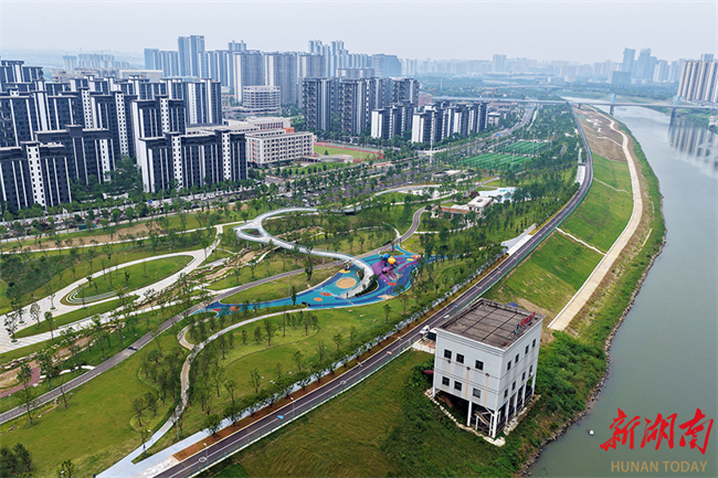
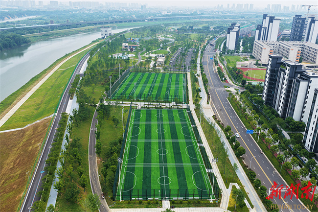
On June 3, the construction of the Liuyang River Scenic Belt (Laodong East Road–Zhashangang Section) Project in Changsha City was generally completed, with some areas already open to the public. Spanning 3.6 kilometers in length and covering a total area of 640,000 square meters, the project follows the theme of "Meandering Liuyang River, Green New Town." The scenic belt features scientifically planned waterfront promenades, sports venues, and children's playgrounds, creating a leisure destination that integrates artistic aesthetics with functional experiences. Additionally, by reshaping the hilly terrain, the project effectively resolves the elevation difference between the riverbank and the city, achieving a seamless integration of the urban landscape and the scenic belt. (Photo/Tian Chao, Hunan Daily)
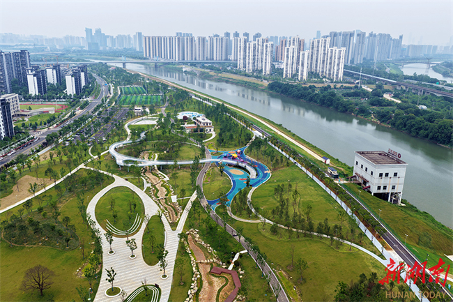
On June 3, the construction of the Liuyang River Scenic Belt (Laodong East Road–Zhashangang Section) Project in Changsha City was generally completed, with some areas already open to the public. Spanning 3.6 kilometers in length and covering a total area of 640,000 square meters, the project follows the theme of "Meandering Liuyang River, Green New Town." The scenic belt features scientifically planned waterfront promenades, sports venues, and children's playgrounds, creating a leisure destination that integrates artistic aesthetics with functional experiences. Additionally, by reshaping the hilly terrain, the project effectively resolves the elevation difference between the riverbank and the city, achieving a seamless integration of the urban landscape and the scenic belt. (Photo/Tian Chao, Hunan Daily)
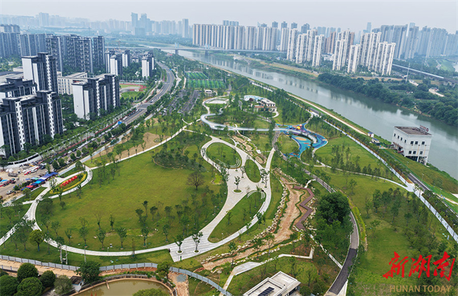
On June 3, the construction of the Liuyang River Scenic Belt (Laodong East Road–Zhashangang Section) Project in Changsha City was generally completed, with some areas already open to the public. Spanning 3.6 kilometers in length and covering a total area of 640,000 square meters, the project follows the theme of "Meandering Liuyang River, Green New Town." The scenic belt features scientifically planned waterfront promenades, sports venues, and children's playgrounds, creating a leisure destination that integrates artistic aesthetics with functional experiences. Additionally, by reshaping the hilly terrain, the project effectively resolves the elevation difference between the riverbank and the city, achieving a seamless integration of the urban landscape and the scenic belt. (Photo/Tian Chao, Hunan Daily)
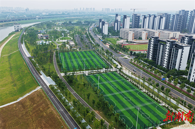
On June 3, the construction of the Liuyang River Scenic Belt (Laodong East Road–Zhashangang Section) Project in Changsha City was generally completed, with some areas already open to the public. Spanning 3.6 kilometers in length and covering a total area of 640,000 square meters, the project follows the theme of "Meandering Liuyang River, Green New Town." The scenic belt features scientifically planned waterfront promenades, sports venues, and children's playgrounds, creating a leisure destination that integrates artistic aesthetics with functional experiences. Additionally, by reshaping the hilly terrain, the project effectively resolves the elevation difference between the riverbank and the city, achieving a seamless integration of the urban landscape and the scenic belt. (Photo/Tian Chao, Hunan Daily)
On June 3, the construction of the Liuyang River Scenic Belt (Laodong East Road–Zhashangang Section) Project in Changsha City was generally completed, with some areas already open to the public. Spanning 3.6 kilometers in length and covering a total area of 640,000 square meters, the project follows the theme of "Meandering Liuyang River, Green New Town." The scenic belt features scientifically planned waterfront promenades, sports venues, and children's playgrounds, creating a leisure destination that integrates artistic aesthetics with functional experiences. Additionally, by reshaping the hilly terrain, the project effectively resolves the elevation difference between the riverbank and the city, achieving a seamless integration of the urban landscape and the scenic belt. (Photo/Tian Chao, Hunan Daily)
Source: en.changsha.gov.cn


 Hunan PSB Cyber Security Filing: No. 43010302000524